Sea Paths: Routes and Memories on Mozambique Island
By Celeste Mandlaze | December 2, 2025
This project grew out of a desire to bring the public closer to these maritime stories, not just as historical data, but as a living part of the communities that continue to inhabit and care for the sea.
The idea for Sea Paths began during my degree in Archaeology and Cultural Heritage Management at Eduardo Mondlane University, when I was looking for ways to promote the underwater cultural heritage of Mozambique Island using digital tools. At that time, I tried working with ArcGIS Story Maps are used for the first time as a way to make visible the routes, objects, and memories that often do not appear in written archives. I realized that the platform allowed me to tell complex stories in an accessible way, connecting space, image, and narrative. Sea Paths is a continuation and deepening of that initial research.
Visualizing the Invisible
The Indian Ocean is a space of constant circulation: goods, people, memories, technologies, music, and words have traveled across these waters and continue to do so. But often, these stories remain scattered, fragmented, or invisible. Sea Paths emerged as a space where these trajectories can be seen, felt, and narrated in a vivid way.
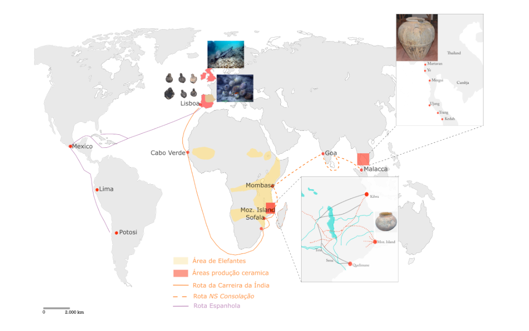
map
I decided to work on this project because I believe that telling these stories is a way of caring for our maritime and underwater heritage while strengthening ties between communities. I grew up close to the sea and have always recognized it as a place of memory, displacement, and return. For me, Sea Paths is a way of recognizing these emotional and historical layers, respecting the plurality of experiences of coastal populations. It is also a way of contributing to making this knowledge accessible, overcoming geographical and institutional barriers.
↓Click Below to Visualize History on the Sea Paths Map ↓
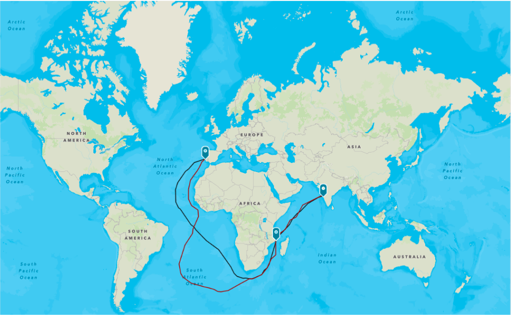
The Story Map presents maritime routes, photographic archives, archaeological remains, oral testimonies, and elements of the cultural landscape, integrated into an interactive digital format. The platform allows visitors to explore the region through its connections—between islands, ports, communities, objects, and memories. More than a map, it is a visual narrative about movement, encounter, and permanence. Each section was designed to bring the public closer to these stories, without simplifying them, but making them accessible to those who may never have had contact with them before. The Nossa Senhora da Consolação shipwreck (IDM003) has been included in the Story Map since my graduation, serving as a starting point for expanding the project to other shipwrecks and revealing the submerged stories of the Indian Ocean.
In addition, Sea Paths is an educational tool. I have used Story Map in seminar classes, induction sessions, and community discussions, both in academic and local contexts. Experience shows that visualizing stories in space facilitates understanding of how broad historical processes—such as trade in the Indian Ocean, maritime labor, coastal cultural networks, and forced mobility—unfold in very concrete ways, affecting real people with lives, families, and identities. Navigating the map invites the public to reflect on the past and on the continuities that run through the present.
“These narratives show that underwater cultural heritage is not just a story of shipwrecks, but also a living legacy that sustains the identity and daily life of the community, reminding us of the importance of preserving and valuing this legacy.”
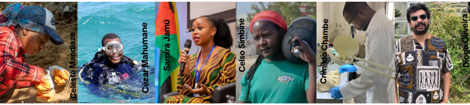
This work was developed in dialogue with colleagues (Cézar Mahumane; Celso Simbine; Samira Jamú; Crimildo Chambe; Diogo Oliveira) and partners (IFAS-Research; UEM-CAIRIM; The George Washington University; Smithsonian Institution; University of Pretoria; College of William & Mary; Slave Wrecks Project; CNRS; UMIFRE, and the French Republic). This collaboration has been fundamental in building approaches that are sensitive to the histories of resistance, circulation, and cultural transformation that mark the region. Sea Paths is part of an ongoing movement to construct narratives that value local voices, memories, and knowledge, while also situating these stories within global networks.
Now that the Story Map is available to the public, I hope it can serve as a meeting place where students, researchers, fishermen, sailors, teachers, travelers, and members of the diaspora can find something that speaks to them or piques their curiosity. I invite everyone to explore, share, and use Sea Paths in an open and collaborative way.